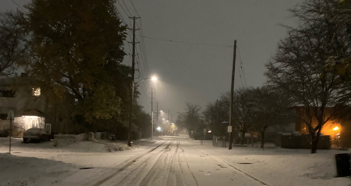
OTTAWA, Feb. 13, 2025 – Ottawa received a massive wallop of snow on Wednesday night and it is expected to continue through Thursday morning delivering up to 40 cm of snow when all is said and done. Wednesday night’s winter storm warning issued by Environment and Climate Change Canada for the capital region continues Thursday morning.
This highly impactful winter storm delivered peak snowfall rates exceeding 5 cm per hour, according to ECCC. The brunt of the storm is expected to end in the capital region by Thursday afternoon, with the heaviest snow falling Thursday morning.
Environment and Climate Change Canada 5:21 AM EST Thursday 13 February 2025
Winter Storm Warning in effect for:
- Ottawa North – Kanata – Orléans
Additional Information:
Snow will fall heavy at times this morning. Moderate winds will produce local blowing snow, especially in the Ottawa River Valley. The morning commute will be impacted. Snow will gradually taper off this afternoon.
Road closures are possible. Consider postponing non-essential travel until conditions improve.
Take frequent breaks and avoid strain when clearing snow. If you must travel, keep others informed of your schedule and destination and carry an emergency kit and mobile phone. Public Safety Canada encourages everyone to make an emergency plan and get an emergency kit with drinking water, food, medicine, a first-aid kit and a flashlight.
For information on emergency plans and kits go to getprepared.gc.ca. Please continue to monitor alerts and forecasts issued by Environment Canada. To report severe weather, send an email to ONstorm@ec.gc.ca or post reports on X using #ONStorm.
photo by Julian Lankstead
Other articles from totimes.ca – otttimes.ca – mtltimes.ca